


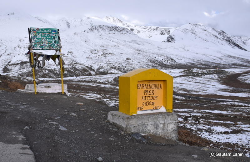
About 145 Kms from Manali, and 3.2 Kms from Suraj Taal, exists the inhospitable terrain of the famed Baralacha La pass.

the Baralacha La Pass; my Jimny had lost
its shinning yellow hue under the bleak sky
Treacherous Terrain
The road became narrow, and uneven. Acute hairpin bends at short distances made me change gears constantly, as I kept the SUV on the boil.
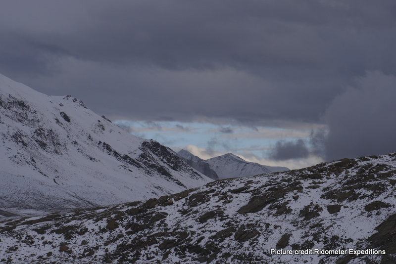
surrounded us at Baralacha La pass
Zansker Himalayan Range
Lofty mountains of the Himalayan Zanskar range, lay on either side, and smeared with snow.
The road was wet, so speed fell as the SUV skidded on the turns with the wheels spinning furiously.
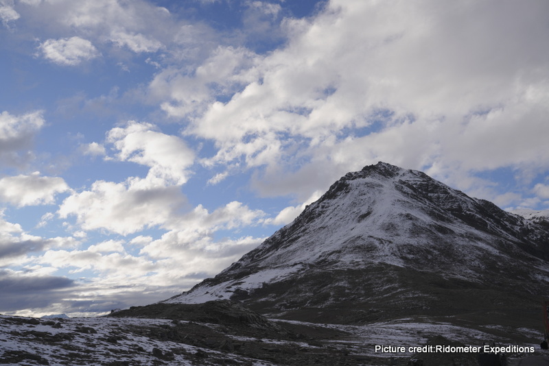
into the cloud scattered blue sky
Deep valleys, and razor-sharp rocky ridges, covered with hard snow greeted us.
The raw mountains of granite and gabbro igneous rocks looked lethal.

crawled to avoid skidding on the wet
road: Picture credit – Ratna Lahiri
A View from the Sky, Our Convoy – Click Play👇
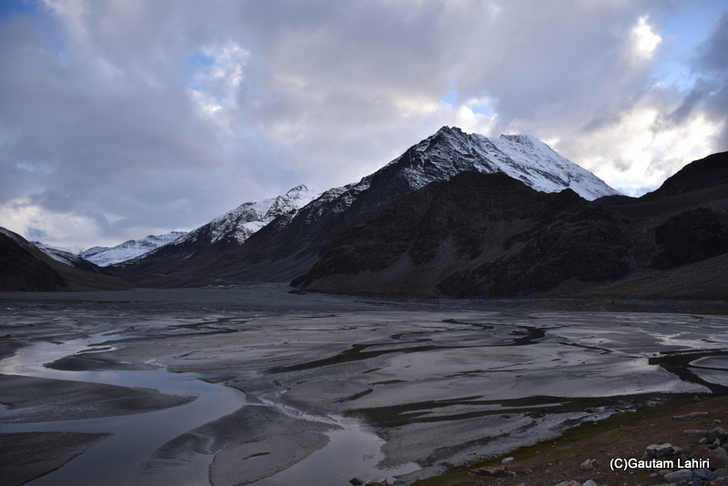
Baralacha La Pass, we stop to see the
breathtaking rivulets that form the glaciers
Baralacha La Pass rests at 16,043 feet above the mean sea level and connects the Lahul Spiti valley to Leh and Kashmir.
The Baralacha La Pass
We had reached the Baralacha La pass
Blackish Brown Snow Peaks
On the road edge, we saw metamorphic rocks like, schists, slates, and quartzites.
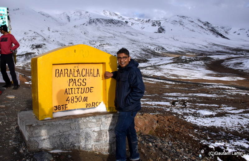
the rugged Baralacha La pass

as if I am standing with tons of chocolate
truffle cakes around me
Glaciers, and Rivers
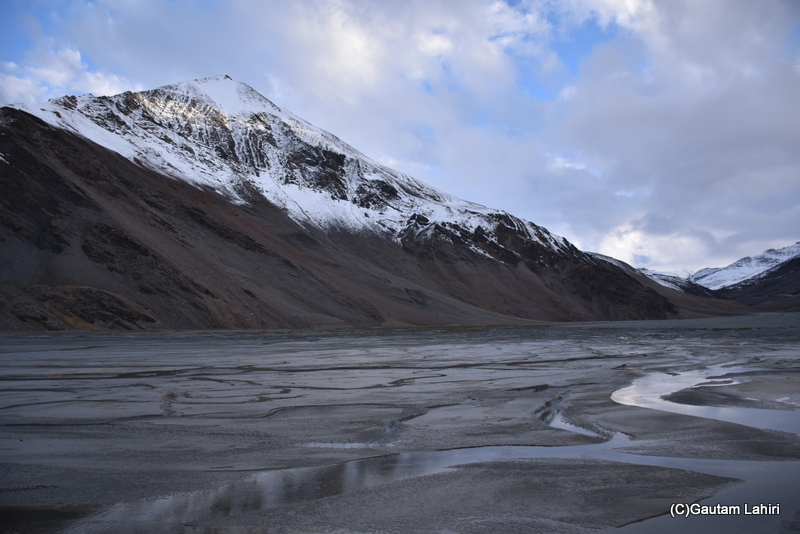
waterways, and they crisscrossed under
the unheeding mountains
An Aerial View of Baralacha La Pass👇
peaks of Baralacha La Pass
Inference
- Baralacha La presents a challenging driving environment for travelers
- It has an extreme weather pattern
- Fiercely unpredictable weather conditions
- No room for any driving error
- High-altitude risks
- Unique geological features and remote beauty attract adventurers
- Best time to visit – August to early October
- Snowfall is the primary source of precipitation, especially during winter
- Area experiences blizzard, and high force gale, pushing the temperature down to -20 C
| Distance from Manali to Baralacha La Pass | 145 Kms |
| Key passes and places you will cross | Rohtang Pass 13,050 ft, and Suraj Taal, 16,043 ft |
| River(s) you will see | Chandra and Bhaga |
| Best time to visit | Late August through early October |
| Alert | The height may bring medical emergency due to less oxygen, as AMS (Acute Mountain Sickness) may set in to a lot of travelers |
For the complete ✨Ladakh Diary Series, click below 👇
