My 🏔️ Himachal Pradesh Diary 🌉 Karchham Bridge to the Sky ☀️: Stunning Drive from Chitkul
Rugged mountain roads snaked across the undulating terrain, acting like a string and holding the beads, like Chitkul, Rakcham, Sangla, and Karchham.
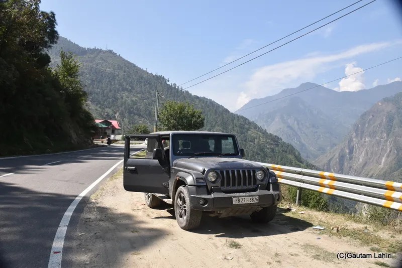
The THAR effortlessly showed us the breathtaking views.
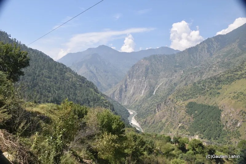
The crystal clear, foamy waters of the Baspa River lashed against the rocks and boulders strewn around the base of the upright hills that went up to meet the Kinnaur-Kailash range.
Every turn was beautiful, surreal, and tranquil.
Rakcham – Hidden Village, Baspa valley
Rakcham is where the Baspa River sings softly. You can see the Himalayan Birch, Deodar forests, and apple orchards grow in abundance, and time seems to stand stillStopped the THAR and soaked in the serenity. You can write a poem with the mountain silence as your soundtrack. You are seeing the Baspa River Basin, where a small Kinnauri community thrives. Far away into the valley, you can see wooden houses with delicate carvings that reflect a blend of Hindu and Buddhist influences
Kinnaur, Land of Gods 🏞️
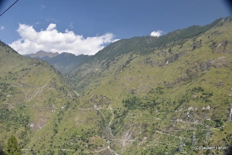
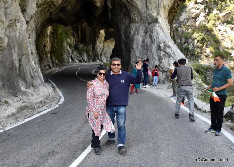
Lush green valleys and barren, uneven Himalayan mountains whizzed past the THAR’s window, and then we saw a tarnished, cemented board welcoming visitors to Kinnaur of the lofty Greater HimalayasThe National Highway 5 connects Kinnaur to the rest of the State. The jagged rocks of the mountains were large and patterned themselves overlapped each other. In some places, the rocks almost touched the highway by broken and extended overhangsKinnaur lies close to the Tibetan border, and large areas of the mountains have been dedicated to both orchards and pine forests. The Sutlej, Baspa, and Spiti rivers have carved out deep gorges, which you can see have been scratched by a thin white line, which was the NH 05, tying the state culturallyWe parked the THAR and stood at the Kinnaur gate, a huge stone arch of about seventy feet, good enough for the tallest trucks to pass. All visitors parked on the road edge to capture memories, and we all did the sameFractured limestone rocks, moraines formed the base of the mountain, and constantly being washed by the Baspa river, it was a sight that could not be missed
Karchham Bridge, Gateway to Two Valleys🏞️
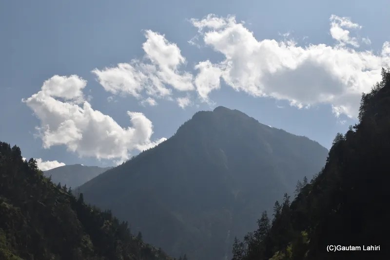
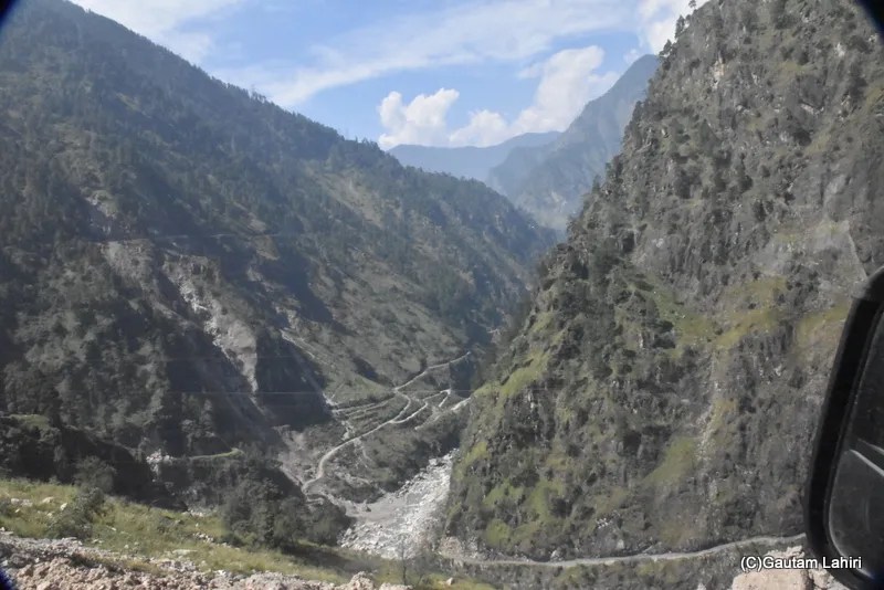
We were all set to explore the Sutlej–Baspa confluence at Karchham. This marks the entry to the Baspa Valley (also called Sangla Valley) from the mainstream Sutlej Valley. Rivers formed these deep gorges. These hills are made of high-grade metamorphic gneiss, schist, and migmatite. Somewhere here is the Leo Pargyil (22,363 feet), the highest peak in Himachal Pradesh
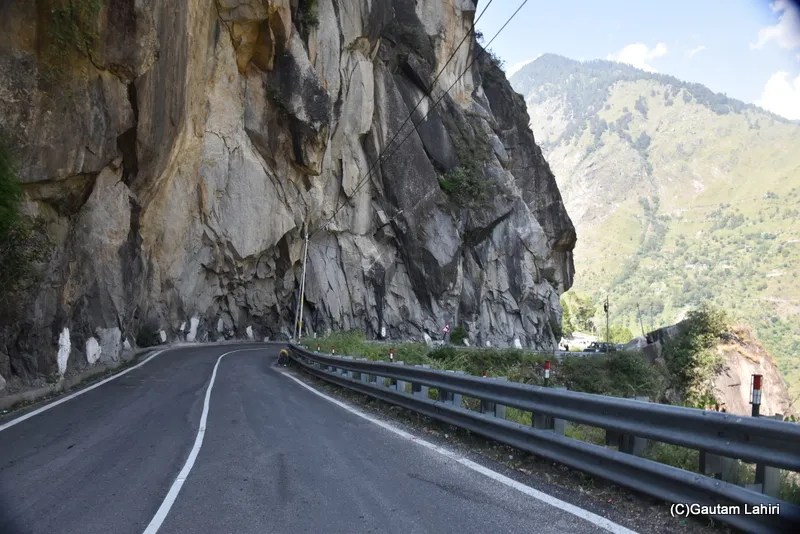
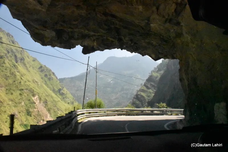
Glimpses of our Mountain Drive🏔️🚗
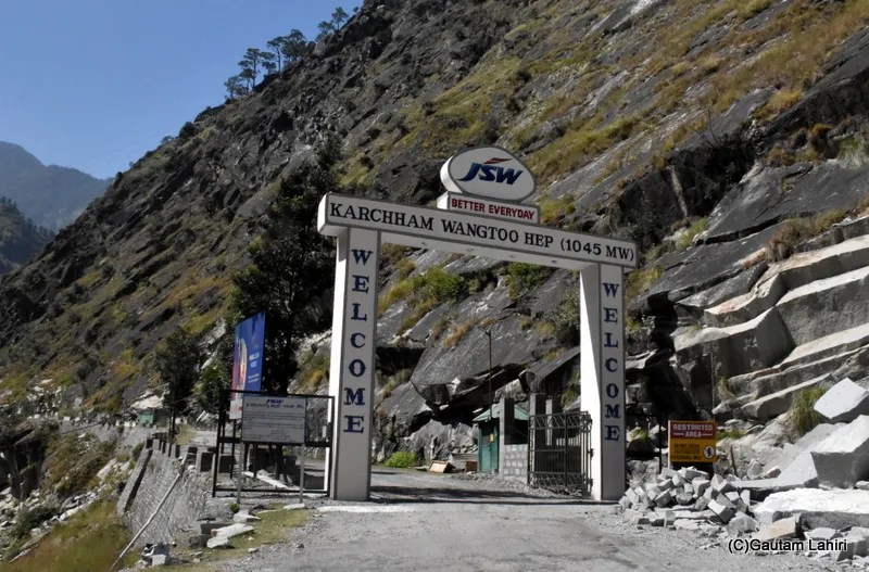
Driving the Greater Himalayas The road to Karchham was unique. The road was curved out below a long buttress of layered rocks. The road meandered around the valleyWe were nearing the Karcham Wangtoo Hydroelectric Project (KWHEP). It is a 1,000 MW run-of-the-river power station on the Sutlej River, located between the villages of Karcham and Wangtoo in Kinnaur districtA steel-truss bridge at Karchham unites two valleys, the Sutlej and the Baspa. The bridge is made at a very important geological spot. A collision and uplift of the Himalayas, zones include the Great Himalaya range, ZanskarThe turquoise green waters of the Sutlej River, formed ripples as the cool mountainous winds hit the water surface, looked beautiful and crystal clear as we stood on the Karchham bridge, with the Zanskar range in the distance
The trek, the drive, gave unparalleled excitement; however, fatigue had also set in. We gunned the THAR for our 🌙 night stay somewhere around the valleys, far away☺️
Inference
🏞️ Karchham lies at an altitude of around 5,900 ft, acting as a natural gateway to the Sangla–Baspa Valley
🌉 This bridge is part of the lifeline connecting Reckong Peo, Kalpa, Sangla, and Chitkul — a route often praised as one of the most scenic drives in India
⚡The Karcham–Wangtoo Hydroelectric Project, one of India’s largest underground hydropower stations. Its tunnels and surge shafts are carved deep into these ancient rocks
🌸 Treks to Charang Valley, Baspa Valley, and Hangrang Valley offer rare, untouched Himalayan trails
Distances
Delhi to Karchham, 535 km / Chandigarh, 330 km / Dhimla, 210 km / Reckong Peo, 45 km
When to go
Spring–Summer April to June Best weather, blooming apple orchards,open roads 🍂 Autumn September – October Clear skies, golden fields, best for photography ❄️ Winter November – March
🍜 Thukpa – Tibetan noodle soup 🥟 Momos – steamed dumplings with spicy chutney 🍲 Sidu – steamed bread made from wheat dough, eaten with ghee or dal 🥔 Chha Gosht – mutton curry with yoghurt (Himachali specialty) ☕ Butter tea (Cha Su Thukpa) – salty tea with yak butter; very warming 🍎 Kinnauri apples & apricot juice – fresh and famous from this region
Travel Tips
My 🏔️ Himachal Pradesh Diary – The Mystical Bhimakali Temple in Sarahan🛕